Northern Manhattan has formed a huge partnership to monitor the environment in its local parks. This collaborative effort focuses on monitoring land, air, and water quality. To engage the community, they are creating opportunities such as nature and trail walks, as well as novice paddling excursions on the Harlem River, offering unique views of Highbridge Park from the water.
Capacity building is the goal. It is impossible for one individual, organization, or agency to accomplish the entire task on their own. Success depends on meaningful participation from a broad range of individuals and groups working together.
LEAD PARTNERS
The West Harlem Art Fund has, since 1998, played a central role in activating public space through art, design, and cultural programming across New York City. Through exhibitions, installations, performances, and community partnerships, the organization has used creative practice as a vehicle for civic engagement, cultural recognition, and neighborhood-led visioning. Its work is rooted in the principle symbolized by Afuntummireku-denkyemmtreku—the double crocodile from Ghana—representing unity in diversity and collective strength through shared space.
The Center for Integrated Earth System Information is an applied research center within the Columbia Climate School with more than three decades of experience integrating social, environmental, and spatial data to support decision-making on climate, public health, and sustainable development. CIESIN’s work emphasizes open data, methodological transparency, and the co-production of actionable information with communities, governments, and civil society, including through global initiatives such as the IDEAMAPS Network.
COMMUNITY-IDENTIFIED PRIORITIES AND FOCUS AREAS
Initial discussions with community partners have identified a shared interest in focusing on parks and public green spaces in Upper Manhattan, particularly where residents and stewards have articulated specific environmental concerns and unmet needs. These priorities originate from lived experience and ongoing stewardship efforts and are summarized below.
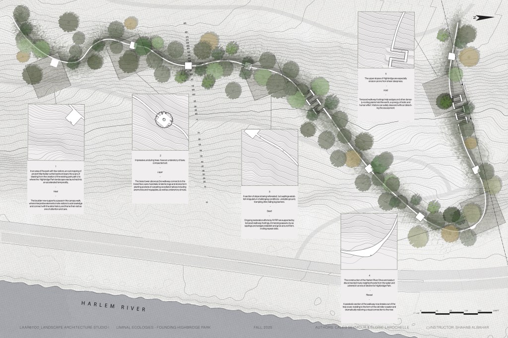
- Highbridge Park (155th Street–200th Street): Community partners have identified a need for improved, site-wide understanding of environmental conditions to support stewardship and advocacy, including the use of spatial data to better document landscape conditions, access challenges, and maintenance needs across this long and topographically complex park.
- St. Nicholas Park: Residents and stewards have highlighted soil erosion and the loss of mature trees as pressing concerns. Suggested community-informed interventions include the use of compost socks or similar nature-based solutions to stabilize slopes, reduce erosion, and improve soil health.
- Jackie Robinson Park: Community observations emphasize soil compaction and overgrowth in forested areas, with interest in targeted training and hands-on remediation approaches that balance ecological restoration with safe public access.
- Parks and green spaces in Morningside Heights: Persistent flooding has been identified as a concern, compounded by difficulty locating or accessing storm drains. Community members have expressed interest in improved mapping and documentation to better understand drainage patterns and support dialogue with city agencies.
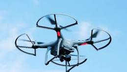
Across these sites, the collaboration will explore—where appropriate and permitted—how citizen drone mapping, field-based observation, and complementary environmental data collection can support community stewardship, inform planning discussions, and strengthen communication between residents and city agencies.
PROPOSED AREAS OF COLLABORATION
Over the initial one-year period, the parties anticipate collaboration across several interconnected areas. These are intended as starting points and may evolve through joint discussion and experience.
- Co-design of pilot activities, including small-scale citizen drone mapping, field surveys, and environmental observation exercises conducted in partnership with community organizations and residents.
- Environmental monitoring and planning, exploring how spatial data and maps can inform stewardship strategies, maintenance planning, and evidence-based proposals to city agencies.
- Youth engagement and workforce pathways, including collaboration with local youth organizations to introduce skills related to environmental monitoring, geospatial data, fabrication, and applied environmental work.
- Capacity exchange and learning, supporting mutual learning among community members, students, researchers, and practitioners through workshops, demonstrations, and shared reflection.
- Creative and public communication, integrating artistic and cultural practices—such as public art, storytelling, or media production—to translate environmental data into accessible and meaningful public-facing outputs.
- Institutional dialogue, identifying opportunities for constructive engagement with city agencies and decision-makers around environmental management, procurement, and stewardship practices.
ROLES AND CONTRIBUTIONS
The collaboration is intended to be non-hierarchical and complementary. The leading partners in this collaboration, and our intended roles are as follows:
- Columbia University collaborators Thomson and MacManus will contribute applied technical expertise in drone operations, environmental sensing, geospatial analysis, and documentation, and student engagement. They also contribute connections with the following organizations and initiatives:
- CIESIN – Columbia Climate School
- Columbia School of Engineering
- IDEAMAPS Network
- Humanitarian Open Street Map Team
- Slum Dwellers International (SDI) federated network
- West Harlem Art Fund collaborator Bailey-McClain will contribute leadership in community engagement, cultural practice, public-space activation, and connection to local organizations, artists, advocates, and residents. She also contributes connections with the following organizations and community leaders:
- Drone Cadet led by Tony Reid – This accelerated training program is designed to prepare participants for the FAA Part 107 Remote Pilot Certification exam within approximately one month. The goal is to provide consistent weekly training that helps participants stay engaged with the material and build the knowledge required to pass the exam.

Leave a comment